Churches and temples in Richmond (Independent City)
This tour visits places of worship, among them churches, cathedrals, synagogues, temples and chapels. Congregations still use many of them and access depends on the hours they keep.
The stops that carry a construction date run from 1834 to 1877. 13 stops, 2.3 miles end to end. One stop is a National Historic Landmark.
Distances are straight lines between the coordinates in the National Park Service Register data, so the walk on the street will be longer. Nobody has walked or checked this as a route, and a listing does not mean a place is open to visitors. Stops last changed Oct 16, 2026.
All walking tours in Richmond (Independent City) → · Every listing in Richmond (Independent City) →
Map
Coordinates come from the National Park Service National Register spatial data, or from Wikidata where the spatial data has no point. The solid line joins the stops in walking order and is not a street route. Listings with a restricted address in the Register are never mapped and never become stops. Data refreshed November 02, 2026.
Walking order
- 1Sixth Mount Zion Baptist Church14 W. Duval St.Building · listed 1996start
- 2Third Street Bethel A.M.E. Church616 N. 3rd St.Building · built 1875 · listed 19750.2 mi from stop 1
- 3Third Street Bethel A.M.E. Church (Boundary Increase)6110-614 N. 3rd St.Building · built 1875111 ft from stop 2
- 4Centenary Church411 E. Grace St.Building · listed 19790.4 mi from stop 3
- 5Second Presbyterian Church9 N. 5th St.Building · listed 19720.1 mi from stop 4
- 6St. Peter's Church800 E. Grace St.Building · built 1834 · listed 19690.2 mi from stop 5
- 7St. Paul's Church815 E. Grace St.Building · listed 1969305 ft from stop 6
- 8First Baptist ChurchNW corner of 12th and E. Broad Sts.Building · listed 19690.2 mi from stop 7
- 9Monumental ChurchNHL1224 E. Broad St.Building · listed 1969449 ft from stop 8
- 10First African Baptist ChurchNE corner of College and E. Broad Sts.Building · built 1877 · listed 1969236 ft from stop 9
- 11Trinity Methodist Church2000 E. Broad St.Building · listed 19870.4 mi from stop 10
- 12Leigh Street Baptist Church517 N. 25th St.Building · listed 19720.4 mi from stop 11
- 13Church Hill North Historic DistrictAlong Marshall, Clay Leigh and M. Sts., bounded by 21st and 30th Sts.Historic district · listed 19970.1 mi from stop 12
2.3 straight-line miles over 12 legs.
Taking it along
- Download the route as GPXFor a handheld GPS or a phone app
- Open all 13 stops in Google MapsSet the mode to walking once it opens
- Open the first stop in Apple MapsThe Apple Maps web link carries one destination, so this is stop 1 only
Other walks in Richmond (Independent City)
- Renaissance Revival architecture in Richmond (Independent City)13 stops · 1.7 milesRenaissance Revival draws on the Italian palazzo, with a rusticated ground floor, round arched windows and a strong horizontal cornice. The Richmond (Independent City) examples on this route went up between 1818 and 1923.
- Greek Revival architecture in Richmond (Independent City)15 stops · 2.4 milesGreek Revival buildings carry low pitched gables, heavy cornices and columned porticoes modelled on Greek temples. The Richmond (Independent City) examples on this route went up between 1841 and 1877.
- Banks and business blocks in Richmond (Independent City)12 stops · 1.5 milesThe route links commercial buildings built between 1858 and 1929. Most were built to hold shops at street level and offices above.
- Houses and mansions in Richmond (Independent City)15 stops · 2.0 milesThe route links houses built between 1809 and 1873. Many are private homes and the stops are meant to be seen from the sidewalk.
Guidebooks to historic places in Virginia
We earn a small commission if you buy through these links. It does not change what we list.
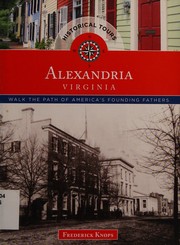
Titles come from Open Library's catalog, matched by subject heading or by title.