Walking tours of Richmond (Independent City)
Greek Revival is the label the register puts on more Richmond (Independent City) buildings than any other, 26 of them. Charles M. Robinson is named on more of them than any other architect.
5 themed routes run through those listings. Of the routes below, two follow a single style and three follow one kind of building. A subject becomes a route only where the register holds enough of it close enough together to walk.
Every listing in Richmond (Independent City) → · 230 in all
The routes
- StyleRenaissance Revival architecture in Richmond (Independent City)13 stops · 1.7 miles · stops last changed Oct 16, 2026Renaissance Revival draws on the Italian palazzo, with a rusticated ground floor, round arched windows and a strong horizontal cornice. The Richmond (Independent City) examples on this route went up between 1818 and 1923.
- StyleGreek Revival architecture in Richmond (Independent City)15 stops · 2.4 miles · stops last changed Oct 16, 2026Greek Revival buildings carry low pitched gables, heavy cornices and columned porticoes modelled on Greek temples. The Richmond (Independent City) examples on this route went up between 1841 and 1877.
- Building typeBanks and business blocks in Richmond (Independent City)12 stops · 1.5 miles · stops last changed Oct 16, 2026The route links commercial buildings built between 1858 and 1929. Most were built to hold shops at street level and offices above.
- Building typeHouses and mansions in Richmond (Independent City)15 stops · 2.0 miles · stops last changed Oct 16, 2026The route links houses built between 1809 and 1873. Many are private homes and the stops are meant to be seen from the sidewalk.
- Building typeChurches and temples in Richmond (Independent City)13 stops · 2.3 miles · stops last changed Oct 16, 2026The route links churches built between 1834 and 1877. Congregations still use many of them and access depends on the hours they keep.
Every route holds at least ten stops and stays under two and a half miles. Routes are computed from the coordinates in the National Park Service National Register spatial data or, where it has no point, Wikidata, and the distances are straight lines between stops. Listings with a restricted address in the Register are never mapped and never become stops. Data refreshed November 02, 2026.
Guidebooks to historic places in Virginia
We earn a small commission if you buy through these links. It does not change what we list.
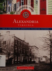
Titles come from Open Library's catalog, matched by subject heading or by title.